![]()
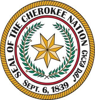
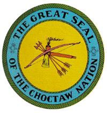
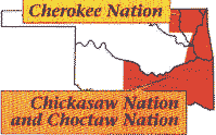
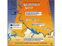
Meandering across northeastern Oklahoma, the Arkansas River traverses the Cherokee Nation. It forms part of the boundary between the Cherokee Nation on the north, and the Choctaw Nation, on the south for 96 miles.
Tribal ownership of the river dates to the Cherokee Treaty of New Echota in 1835 and the Treaty of Dancing Rabbit Creek between the U.S. and the Choctaw Nation in 1830. Chickasaw participation in ownership dates to the Treaty of January 17, 1837.

Because the river was a navigable stream, the land under it was not allotted; that is to say, it was not conveyed to individual owners when the Tribes were forced to break up their land bases in preparation for Oklahoma statehood.
Because ownership of the land over which the river flows was not conveyed, the tribes retained ownership according to their original treaties. However, the State of Oklahoma claimed ownership, and the tribes lacked the resources to pursue their rights for many years.

During the 1960s, the federal government began work on the McClellan-Kerr Navigation Project. During that same time frame, the Cherokees, Choctaws, and Chickasaws sued the State of Oklahoma to reclaim their ownership rights. After losing two lower court decisions, the tribes appealed to the United States Supreme Court. In a historic 1970 decision on the eve of the completion of the inland waterway, in Choctaw Nation v. Oklahoma, 397 U.S. 620 (1970), the high court confirmed the tribes' ownership of the riverbed. This is a direct quote. "We thus conclude that the United States intended to and did convey title to the bed of the Arkansas River below its junction with the Grand River within the present State of Oklahoma in the grants it made to petitioners. Therefore, the Court of Appeals' judgments are reversed, and the cases are remanded for further proceedings consistent with this opinion. It is so ordered."
This decision furnishes a great deal of detail about the legal history of the Tribal ownership of this 96-mile section of the Arkansas River, between the confluence of the Arkansas, Grand, and Verdigris rivers - the "Three Forks" area near Muskogee - and the Oklahoma-Arkansas boundary, near the Garrison Ave—the bridge between the Cherokee Nation and Fort Smith, Ark.
The Supreme Court remanded it back to U. S. District Court Eastern District to determine the unresolved issues in Docket 6219; see Abstract of Case for detailed information.
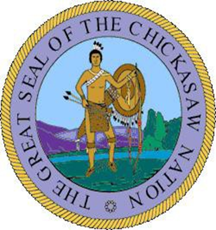
Judgment 73-332-Civil U.S. Dist. Ct, Eastern District of Oklahoma 4-15-1975, orders that the south portion of the Arkansas River bed from the Canadian fork to the Arkansas-Oklahoma border belongs to the Choctaw Nation having an undivided 3/4 interest and the Chickasaw Nation had an undivided 1/4 interest; that the thread of the main channel of the said river shall be the dividing line of the river bed and the Cherokee Nation has the north portion of the Arkansas River bed from the Canadian fork to the Arkansas-Oklahoma border in fee simple.
It was also determined that the portion of the bed of the Arkansas River from the confluence of the mouth of the Grand River to the intersection of the Canadian River is owned in fee simple by the Cherokee Nation.
The effective date of this judgment shall be the 16th day of November 1907, when Oklahoma became a state and technically took possession of the Arkansas River, which was continued until the Supreme Court decision in Choctaw v Oklahoma, 397 U.S. 620 (1970). See the Riverbed Ownership page for more information. Also, see Associate Solicitor Opinion dated 8-16-1983.
After years of negotiation following the Supreme Court ruling, the Nations reached a settlement agreement with the United States government over using the riverbed. Late in 2002, The Settlement Committee submitted the Cherokee, Choctaw, and Chickasaw Nations Claims Settlement Act. The Final Act was approved on December 13, 2002. The purpose was to solve all claims that have been or could have been brought by the Cherokee, Choctaw, and Chickasaw Nations against the United States. Confirm that the Indian Nations are forever disclaiming any right, title, or interest in the Disclaimed Dry bed Lands, which are contiguous to the channel of the Arkansas River. This area is located in Township 10 North in Range 24 East, Township 9 and 10 North in Range 25 East, Township 10 North in Range 26 East, and in Townships 9 and 10 North in Range 25 East, and Township 10 North in Range 26 East and Townships 10 and 11 North in Range 27 East, in the State of Oklahoma. The Indian Nations did retain the Wet Bed Lands in the above locations that lie below the mean high-water mark of the Arkansas River in the State of Oklahoma as of the date of the enactment of this title. The Term Wet Bed Lands is intended to have the same meaning as the Present Channel Claim Area as utilized by the Bureau of Land Management Cadastral Survey Geographic Team in its preliminary survey of the Arkansas River. The Indian Nations did not relinquish any right, title, or interest in other Riverbed lands. No provision of this title shall be construed to extinguish or convey any water rights of the Indian Nations in the Arkansas River or any additional stream. Nor any beneficial interest of title of the Indian Nations to lands held in trust by the United States on the enactment of this title, which lies above or below the mean high-water mark of the Arkansas River. The Indian Nations did not relinquish any right, title, or interest in any lands or minerals of individual unallotted tracts identified in the official records of the Eastern Oklahoma Regional Office, Bureau of Indian Affairs. The Nations gave up their rights to the Disclaimed Dry Bed lands to private citizens, including some Cherokee, Choctaw, and Chickasaw Nations members. This settlement kept the federal government from pursuing court action to remove those Oklahoma citizens from those land. Those court proceedings would be costly to the government and the individuals involved and take many years to resolve.
Presently, the Department of the Interior, Bureau of Land Management (BLM) has completed plats representing the ordinary high water mark (OHWM) of 2003 left and right bank of the Arkansas River, as digitized from aerial photography (identifying said riverbed as instructed by the Settlement Act Public Law No. 107-331, enacted December 13, 2002). `Dry bed Lands' also includes any lands identified in the `Holway Study.

The Nations will continue to own the wet bed of the river from bank to bank, with a total of 4,790.14 acres. They also retained their unallotted lands that remain in the dry-bed areas as defined in Section 604 (2) Special Provisions (C). The Indian Nations do not relinquish any right, title, or interest in any lands or minerals of individual unallotted tracts, which are identified in the official records of the Eastern Oklahoma Regional Office, Bureau of Indian Affairs. The disclaimer to be filed by the Secretary of the Interior under section 605(b) (1) of this title shall reflect the legal description of the unallotted tracts retained by the Nations. This area is also defined as the lower reach.
The Nations did not give up any claims to the wet bed of the Arkansas River or lands that lay in the old riverbed from 10n-23e to the Three Forks Area near Muskogee, Oklahoma. This area is further defined in Section 602 (17). In those resolutions, each Indian Nation expressly reserved all of its beneficial interest and title to all other Riverbed lands, including minerals, as determined by the Supreme Court in Choctaw Nation v. Oklahoma, 397 U.S. 620 (1970), and further reserved any right, title, or interest that each Nation may have in and to the water flowing in the Arkansas River and its tributaries. BLM surveys have now been completed on the upper reach of the Arkansas Riverbed.
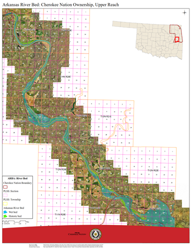
The Nation's ownership extends from the Three Forks Area to the Arkansas State Line, approximately 89 river miles with over 25,545.78 acres of trust lands. The portion of the Arkansas River from Three Forks to the Mouth of the Canadian River belongs entirely to the Cherokee Nation, covering a distance of 40 miles with 10,589.47 acres of wet bed and 1,080.14 dry bed acres. The portion of the river from the mouth of the Canadian River to the Arkansas State Line is jointly owned by the Cherokee, Chickasaw, and Choctaw Tribes. This covers over 49 miles, with approximately 13,876.17 wet bed acres.
![]()